| ©The Archaeological Settlements of Turkey - TAY Project | ||||||
|
|
||||||
Pedasa / Pedason |
||||||
|
|
||||||
| Ages | Maps | Photos | ||||
| Greek-Roman |
 |
 |
||||
|
|
||||||
|
Type:
|
City | |||||
|
Altitude:
|
m | |||||
|
Diameter:
|
m- Direction: | |||||
|
|
||||||
|
Region:
|
Aegean | |||||
|
Province:
|
Mugla | |||||
|
District:
|
Yatagan | |||||
|
Village:
|
Eskihisar | |||||
|
|
||||||
|
|
||||||
|
|
||||||
|
TAYEx:
|
- | |||||
|
|
||||||
|
Registration State:
|
For detailed registration information please refer to Turkish pages. | |||||
 |
||||||
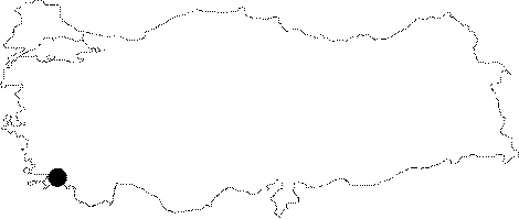
| Location: It is suggested that the remains found approximately 3-4 km far from the ancient city of Stratonikeia within the borders of the Eskihisar Village; 6 km west of the Yatagan District of the Mugla Province belong to the ancient city of Pedasa [Varinlioglu 1993:215]. However; Bean and Radt reported that the ancient city of Pedasa or Pidasa is located on the eastern side of the Grion Mountain at the Cert Osman Kale (See Pidasa) [Bean 1976:682]. |
| Geography and Environment: |
| Destruction Details: |